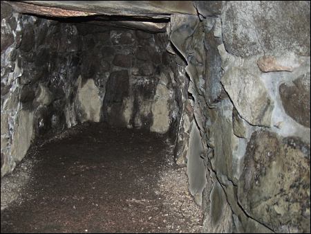
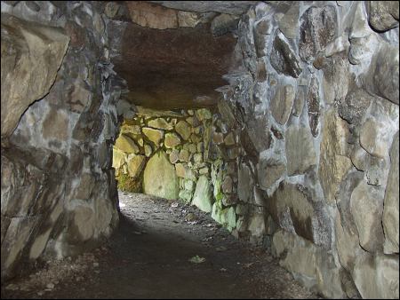
Culsh Earth House

Culsh Earth House
Type:Earthworks
Country:Scotland
County:Aberdeenshire
Grid Ref:NJ504055
Latitude:57.137630
Longitude:-2.819621
Accuracy:to 15m (GPS with SA off)
Datum:WGS84
Date:April 2005
local map:view map
View in Google Earth:KML file
Culsh Earth House Earthworks
nearby sites
TomnaverieStone Circle, 2.7km
Waulkmill Stone Circle, 3.1km, NJ473052
Melgum Stone Circle, 3.2km, NJ472052
Logie Coldstone Stone Circle, 4.5km, NJ459055
AboyneStone Circle, 6.8km
Drumfours Stone Circle, 7.9km, NJ561110
Howemill Stone Circle, 9.2km, NJ580107
Blue Cairn Stone Circle, 9.3km, NJ411063
Balnacraig Stone Circle, 10.1km, NJ603035
GlenkindieStanding Stone, 10.6km
North StroneStone Circle, 11.5km, NJ584138
Nether Balfour Stone Circle, 12.2km, NJ539172
Auld Kirk O Tough Stone Circle, 12.7km, NJ625092
Druidsfield Stone Circle, 14.3km, NJ578177
TomnagornStone Circle, 14.9km, NJ651077
This is not strictly an earthworks, more a souterrain. Earth houses were not houses for living in, and do not seem t have had a defensive purpose as they are obvious from the ground. They may have been more a type of cellar. These were usually built next to a hut in a small group of dwellings, and this one dates from around 0BC. Just inside the passage on the left side there is a cup-marked stone the builders presumably swiped from a stone circle. Wish I'd read that before my visit ;-)


M E g A L i T h i A
Text and photographs © RM 1992-2007 unless otherwise credited
Last updated 18-Mar-07