Avebury
Wiltshire, NGR SU103700
Avebury does "as much excell Stonehenge as a Cathedral does a parish church"
John Aubrey
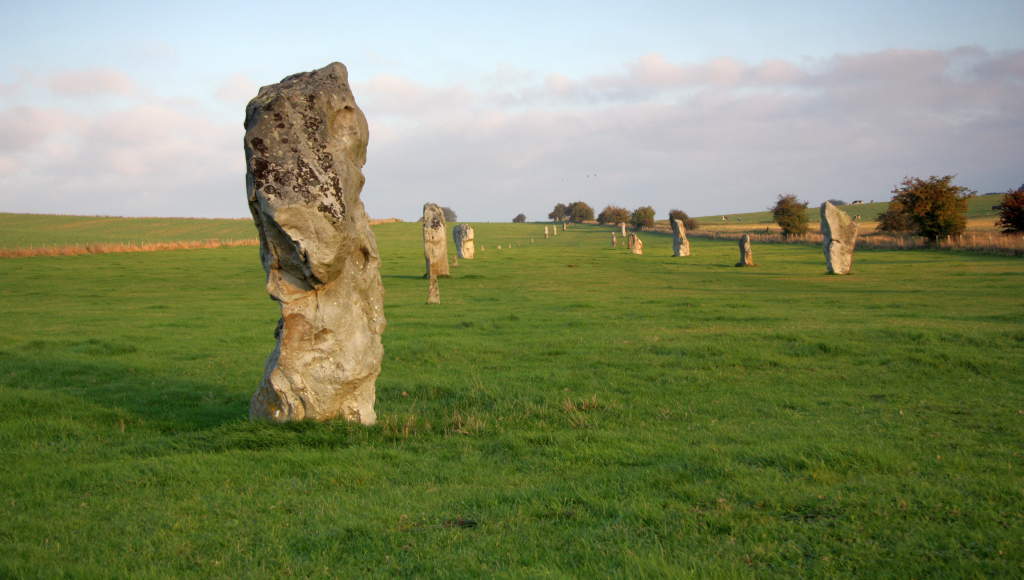
West Kennet Avenue - leading to the Avebury circle
Avebury's profile is dwarfed in the guidebooks by smaller, neighbouring Stonehenge, yet Avebury is an enormous prehistoric site, enclosing an entire village within its henge. No mere slight ditch in the ground, the henge at Avebury is a ditch 30ft (9m) deep rising to a bank over 15ft (4m) high. The site encloses 28 acres (11.5ha) and held 98 standing stones of local sarsen - these sarsens are not dressed like those at Stonehenge, but left in their natural state. This is megalithic design on a grand scale, a great ring of stones enclosing two smaller rings, and one, possibly two, avenues of stones leading out from the henge.
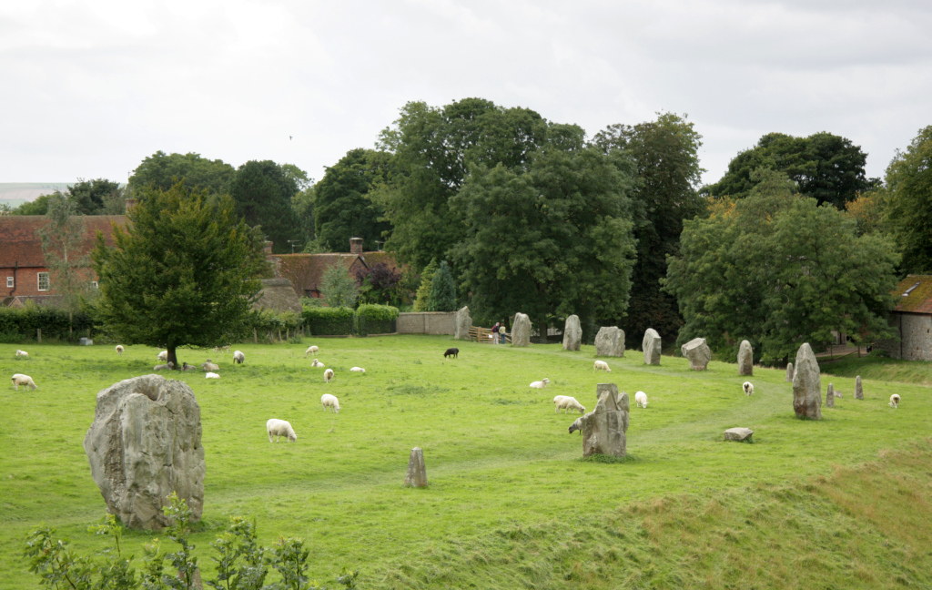
the village nestles in the circle-henge
Christian zealotry and its fear of the pagan meant that many of Avebury's stones were buried in the 15th century lest the attraction of the Church be dimmed by such an obviously impressive monument - in retrospect though this did the archaeological evidence no good perhaps it was to the good saving these stones from the attention of the Victorian vandals and farmers.
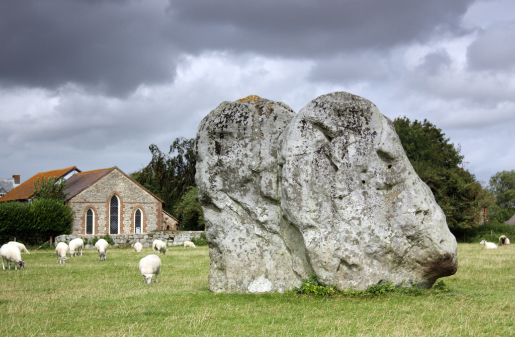
The chapel is smaller than the stones
The chapel dwarfed by stones - being upstaged like this did not give the Christian zealots a good feeling towards the stones
No mention of Avebury is complete without talk of three more recent individuals in historic times. Without these men, our knowledge of Avebury would be much poorer than it is. John Aubrey, whose careful fieldwork recorded much of the plan of the stones before the destruction of much of the site by Victorian farmers. William Stukely, building on some of Aubrey's work, studied the stones before the destruction of much of the circle by Victorian farmers which he also recorded. The site was finally secured by Alexander Keiller, who bought the site in the 1930s and restored many of the stones to their rightful places. The stones are now in the care of the National Trust.
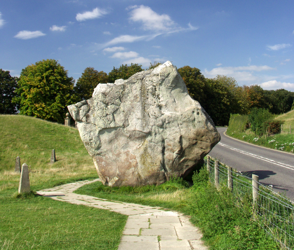
The massive Swindon stone by the road leading out of the circle to the north
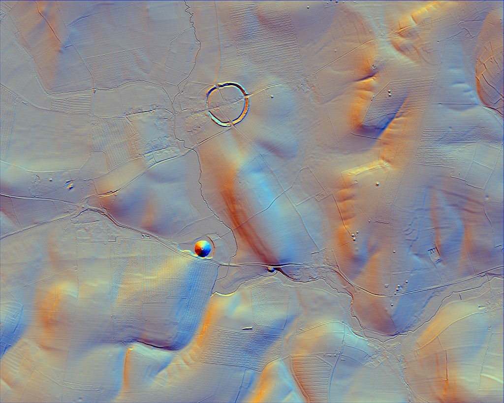
Derived from LIDAR Digital Surface Model data. © Environment Agency copyright and/or database right 2015. All rights reserved.
From the circle-henge a sinuous avenue runs for 1.5 miles (2.3km) made of pairs of standing stones. Only parts of this, the West Kennet Avenue, are to be seen, and much of what there is has been excavated and restored. According to William Stukely, who wrote much about Avebury in the 18th century, another avenue of stones, Beckhampton Avenue, ran to the south-west. However, not enough remains of this to be clearly seen.