St Peter and Paul
St Peter and Paul
Type:
Cross
Country:
England
County:
Suffolk
Grid Ref:
TL705470
Latitude:
52.094720
Longitude:
0.489670
Accuracy:
to 15m (GPS with SA off)
Datum:
OSGB36
Date:
October 2004
local map:
view map
View in Google Earth:
KML file
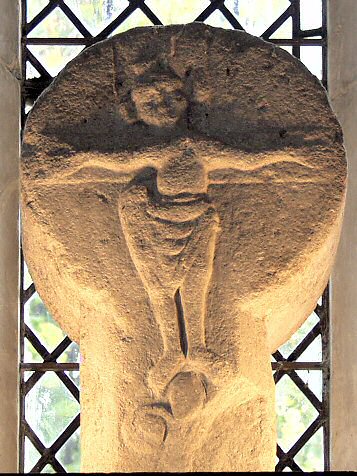
The Saxon cross-head was discovered under the floor in the 19th century, and moved to its current setting above the altar.
nearby sites
The Hartest Stone
stone, 14.1km
St Andrews
Cross, 14.9km
Melford Cross
Cross, 16.0km
Baal Stone
stone, 16.1km
Melford Well
well, 16.1km
Mutlow Hill
Barrow, 17.4km
M E g A L i T h i A
Text and photographs ©
RM
1992-2007 unless otherwise credited
Last updated 18-Mar-07