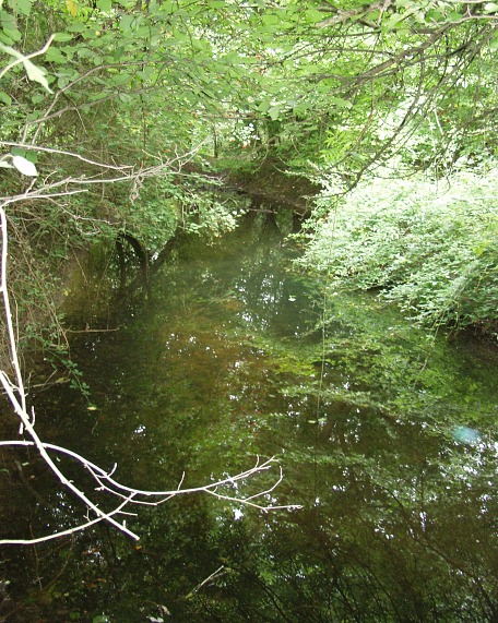
Lady Well

Lady Well
Type:well
Country:England
County:Suffolk
district:Woolpit
Grid Ref:TL976627
Latitude:52.226550
Longitude:0.893460
Accuracy:to 15m (GPS with SA off)
Datum:OSGB36
Date:August 2004
local map:view map
View in Google Earth:KML file
Lady Well well
nearby sites
WoolpitCross, 0.3km
Preaching Stonestone, 13.1km
RickinghallCross, 13.9km
Baal Stonestone, 16.0km
ThelnethamCross, 16.1km
St AndrewsCross, 16.5km
The Hartest Stonestone, 17.4km
Wortham's Sacred StoneCross, 19.3km
Melford CrossCross, 19.6km
Melford Wellwell, 19.7km
Ipswichmodern circle, 22.3km away
In a meadow on the outskirts of the village, the Lady Well is in a basin in the moat. The brick enclosure is the well itself, but it is hard to find in the moat. The well together with the image of Our Lady in the church was a draw for mediaeval pilgrims; the waters had a reputation for healing afflicted eyes.

References


Holy Wells & Ancient Crosses, ESNA, 1978, Michael Burgess, p9
 

M E g A L i T h i A
Text and photographs © RM 1992-2007 unless otherwise credited
Last updated 18-Mar-07